The Mission
What is UNE ASPIRE?
Raw satellite data is insufficient without immediate, high-fidelity context. UNE ASPIRE acts as the intelligent "Translation Layer" for Australia's environmental ecosystems.
We connect terrestrial flux towers, riverine aquatic sensors, and high-resolution aerial spectroscopy directly into cutting-edge AI neural networks. This fusion resolves the atmospheric blurring that impacts orbit-based satellites, turning raw bytes into verifiable, actionable operational truth.
By synthesizing these complex data streams, ASPIRE is building the first comprehensive Australian Spectral Library—a foundational asset for national environmental policy and resource management.

Ecosystem Surveillance
UNE Aquatic Ecology Lab
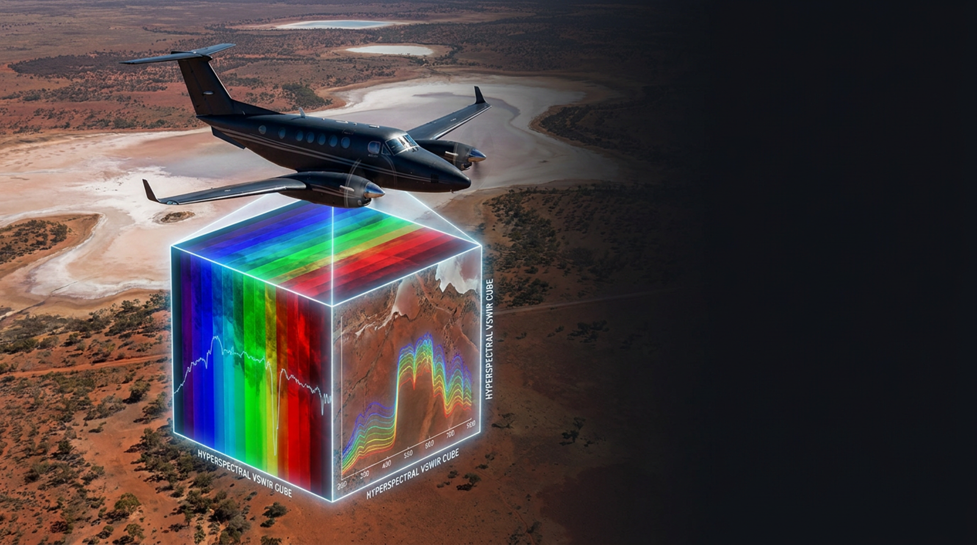
The Catalyst
The 2026 NASA AVIRIS Visit
In October 2026, the NASA JPL AVIRIS team undertakes a time-limited, 6-week airborne deployment across Australia. This provides the ultra-high-resolution airborne mapping required to calibrate and jump-start our national models.
Benefits to Australia:
-
↗
Unprecedented Validation Rapid baseline benchmarking of complex terrain, transitioning Australia from passive satellite consumers to active, precise data validators.
-
↗
Emissions & Biodiversity Mapping Direct, verified detection of fugitive greenhouse gases (methane/CO2) and hyper-accurate tracking of sub-seasonal vegetation and fuel moisture prior to fire seasons.
-
↗
Water Security Resilience Advanced optics map inland water qualities, suspended solids, and coastal ecologies (like reef anatomies and algal blooms) bypassing deep atmospheric interference.
Establishing Sovereign Capability
The 2026 NASA deployment is the launchpad. We are securing the intelligence and the blueprint to eventually commission "AVIRIS Oz"—a bespoke, sovereign imaging spectrometer that will cement Australia as the Earth Observation leader of the Asia-Pacific.